

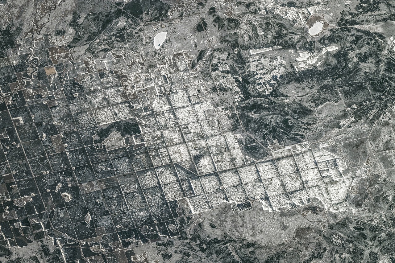
From 267 miles above Earth, the International Space Station captured a striking image of snow-blanketed fields at the southern tip of Lake Winnipeg in Manitoba, Canada. This photograph, taken by ESA astronaut Sophie Adenot, sparked a flurry of insightful observations from readers intrigued by the geometric patterns and frozen landscape. The May 2026 NASA Earth Observatory puzzler challenged viewers to identify this unique location and uncover the story behind its distinctive appearance.
What the Image Reveals: Agriculture Meets Glacial History
The photograph showcases vast agricultural fields coated in snow, arranged in a clear grid pattern that stands out against the natural surroundings. These fields lie on a flat glacial clay plain—the ancient bed of Lake Agassiz, a massive prehistoric lake that once covered much of central North America. Today, this land supports the cultivation of wheat, barley, oats, and canola, crops that thrive in the region’s short growing season and fertile soil.
Shweta Vashisth, the first reader to identify the location, noted the distinctive grid pattern used for farming. She highlighted the impressive technical details of the capture: the image came from a Nikon Z 9 camera with a 400mm lens aboard the ISS during its 74th expedition, taken on April 19, 2026. The photograph captures the interplay between human agricultural activity and the stark frozen landscape below, illustrating how natural forces and human ingenuity blend to shape this region.
The Dominion Land Survey: Shaping Western Canada’s Farmlands
David B. explained that the grid system visible in the image results from the Dominion Land Survey (DLS), a historic method used to parcel much of Western Canada into square townships and sections. This land division system was fundamental in facilitating settlement and organized agricultural development across the prairies. The rectangular field layouts reflect this systematic approach, which remains visible even under a blanket of snow.
Frozen Earth: Geological Forces at Play
Prathapani Prakash provided a geological perspective on the scene. The land beneath the snow is a flat glacial clay plain shaped by the remnants of Lake Agassiz and modified by a river delta. In the sub-freezing temperatures of winter, this water-saturated clay hardens into a rigid surface. Geological processes such as frost heave, ice lensing, and lake-ice scouring actively reshape the terrain during the cold months, creating subtle but dynamic changes in the landscape.
Adding further context, Martin pinpointed nearby landmarks visible in the image, including Gull Lake in Manitoba, providing precise coordinates (50°24’32.31″N 96°30’51.32″W). This helps anchor the image geographically and aids in understanding the relationship between the frozen fields and surrounding water bodies.
Why This Matters: Connecting Earth Observation and Public Engagement
NASA’s monthly satellite puzzlers serve as more than just a fun challenge—they invite the public to engage deeply with Earth science and remote sensing technologies. Each puzzle encourages participants to analyze satellite images, recognize geographical and geological features, and appreciate the complexity of Earth’s landscapes from space.
This particular puzzler highlights the intersection of natural history, climate, and human activity. Understanding how ancient glacial lakes like Agassiz have shaped modern agricultural lands enriches our knowledge of Earth’s evolving surface. Moreover, it underscores the importance of satellite imagery in monitoring and studying these changes over time, which can inform environmental management and land use policies.
The Value of Community Insight
The diverse responses from readers demonstrate how citizen science can enhance scientific observation. From identifying camera equipment and orbital details to explaining geological phenomena and land survey systems, community contributions add layers of interpretation that deepen collective understanding.
Looking Ahead: The Ongoing Puzzle of Earth Observation
NASA’s Earth Observatory continues to challenge and educate with monthly puzzlers that reveal the planet’s hidden stories. By encouraging close examination of satellite imagery, these challenges foster curiosity and scientific literacy among global audiences.
As the seasons change and landscapes evolve, satellite images will keep capturing Earth’s dynamic surface, offering endless opportunities for discovery. The May 2026 puzzler reminds us that even familiar places like Manitoba’s farmlands hold intricate details visible only from above—waiting to be explored and understood.
Stay tuned for future puzzles and keep looking up; the next extraordinary view might be just a click away.