

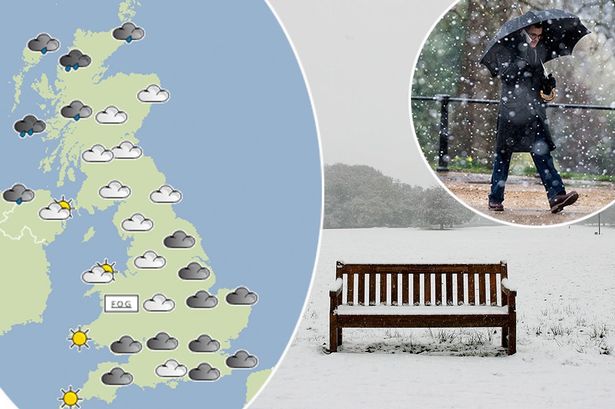
March Brings One of the Coldest Months on Record, But Signs of Spring Emerge
After enduring one of the chilliest starts to the year in over a century, there is finally hope that the harsh grip of winter is loosening. March 2013 has registered as the second coldest March since official weather records began in 1910, marking an unusually prolonged freezing spell that has tested patience across the UK and Ireland. Yet, amid this sustained cold snap, meteorologists are increasingly confident that the much-anticipated arrival of spring warmth is imminent.
According to data from the Met Office, the average temperature across the UK last month hovered around 2.2 degrees Celsius (36 degrees Fahrenheit). This is just slightly warmer than the coldest March on record in 1962, which averaged 1.9 degrees Celsius (35 degrees Fahrenheit). Remarkably, the chilling temperatures in March 2013 were lower than those recorded in any of the preceding winter months of December, January, or February, a rare meteorological occurrence that underscores the severity of this year’s cold spell.
__IMAGE_PLACEHOLDER_1__
What Made March 2013 So Unusually Cold?
Such a prolonged cold period in March is not something meteorologists observe every year. The last time the UK experienced a March colder than the entire winter season was in 1975. That year, the unusually cold spring was followed by one of the better summers in recent memory, providing some optimism that this year could see a similar turnaround.
Sky Weather Producer Jo Robinson highlighted this historical parallel, noting that after enduring an extended cold spell, the atmosphere is beginning to shift. She explained, “After such a cold spell, there’s finally increasing confidence that spring warmth is just around the corner.” Robinson emphasized that while the chill will persist in the short term, the key atmospheric driver behind the change is the movement of the jet stream.
The jet stream, a fast-flowing air current high in the atmosphere, plays a crucial role in shaping the UK’s weather. During the cold spell, it remained positioned to the south, funneling freezing air down from the Arctic. However, as the jet stream gradually shifts northwards, it will allow milder air masses from the Atlantic to move across the region, bringing warmer temperatures and more typical spring conditions.
__IMAGE_PLACEHOLDER_2__
What to Expect in the Coming Weeks: A Transition to Warmer Weather
Despite the hopeful signs, the cold theme is set to continue for at least the next few days. Temperatures will remain below average, and gusty winds will contribute to a biting chill, making conditions feel colder than the thermometer suggests. The persistent wind will also bring spells of rain, which, combined with the cool air, means outdoor activities will still require warm clothing and caution.
Looking ahead, forecasters project that by the start of next week, the jet stream’s northward shift will finally bring a welcome break from the unseasonal cold. Temperatures are expected to climb to more typical spring levels, hovering around 10 to 12 degrees Celsius, and by midweek, some areas could see daytime highs reaching the mid-teens Celsius.
Computer weather models suggest that mid-April may usher in even more settled and warmer conditions. While spring weather is often changeable, these models indicate the possibility of longer spells of sunshine and mild temperatures, a stark contrast to the frosty start of the season.
__IMAGE_PLACEHOLDER_3__
Why This Matters: The Impact of an Extended Cold Spell and the Promise of Spring
Extended periods of below-average temperatures can have wide-ranging effects on daily life, agriculture, and ecosystems. Prolonged cold can delay the growth of crops, affect flowering times in plants, and impact migratory patterns of wildlife. For people, sustained cold weather increases energy demands and can exacerbate health issues, especially among vulnerable populations.
The anticipation of a return to milder weather brings relief not only to individuals but also to farmers and industries reliant on seasonal cycles. Warmer temperatures support the budding of flora and the awakening of fauna, signaling the natural rhythm of renewal and growth.
While the recent cold snap has been remarkable, the approaching shift in weather patterns serves as a reminder of the dynamic nature of the climate system. The jet stream’s movement demonstrates how atmospheric forces govern local weather and how quickly conditions can change.
As spring warmth approaches, it offers a chance to shake off the winter chill, enjoy outdoor activities, and look forward to a season of rejuvenation. However, it also underscores the importance of monitoring weather trends closely, as shifts in the jet stream and other factors can bring surprises.
Looking Forward: Embracing the Change of Seasons
The end of this extraordinary cold spell is finally within sight. While the UK and Ireland have endured one of the coldest Marches in over a century, the gradual northward migration of the jet stream promises a return to more familiar and comfortable spring weather. Temperatures climbing into the teens Celsius and more settled conditions by mid-April will mark a welcome transition.
As the seasons turn, the experience of this harsh winter will serve as a benchmark for future weather patterns. The resilience shown during the cold months sets the stage for embracing the warmth and vitality that spring invariably brings.
In the coming weeks, residents can look forward to shedding layers, spending more time outdoors, and witnessing the natural world burst back into life. After such an extended freeze, the arrival of spring warmth will be all the more appreciated.