
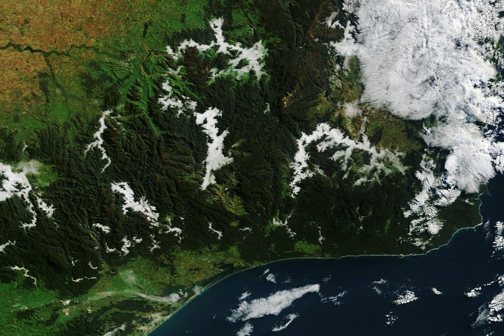
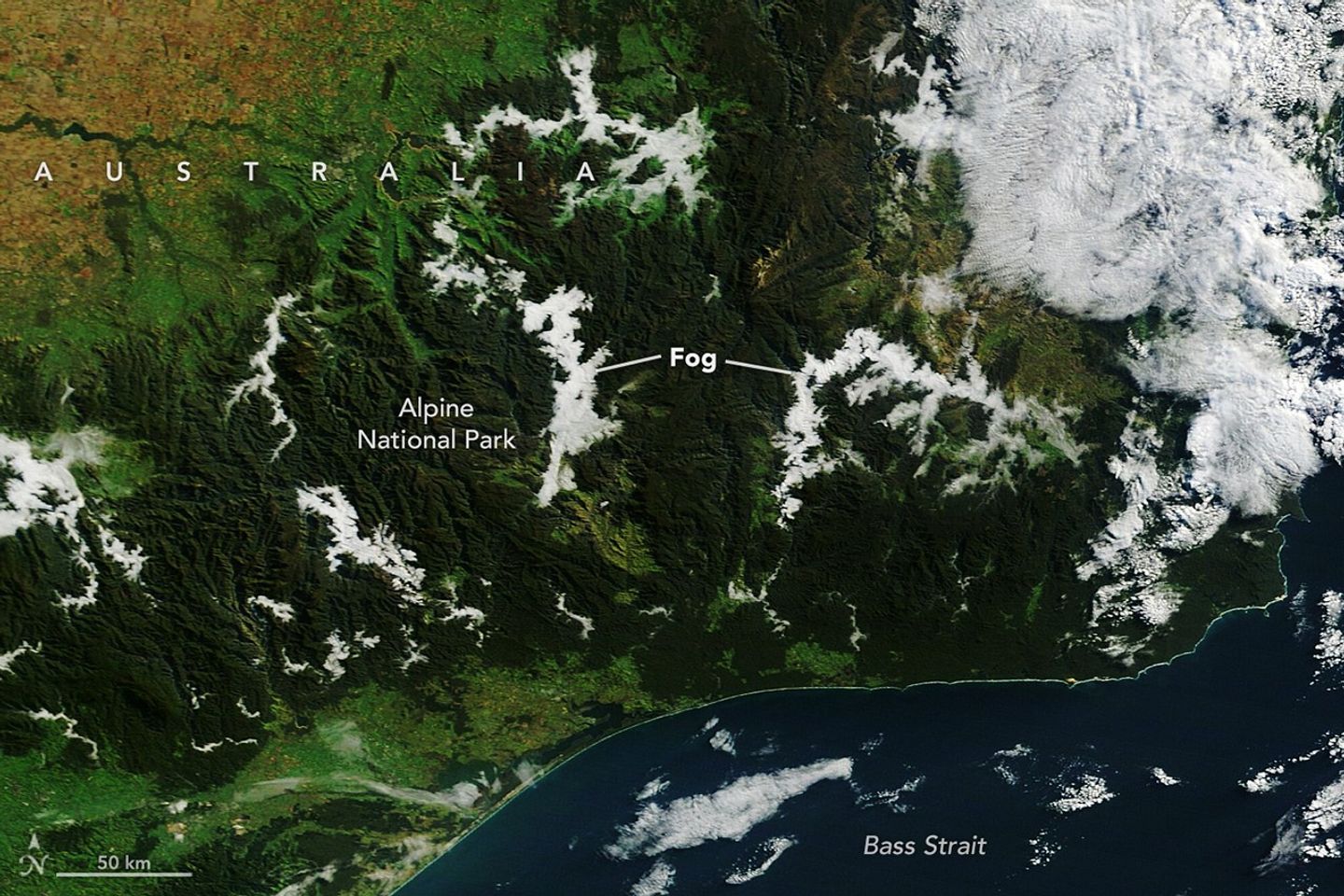
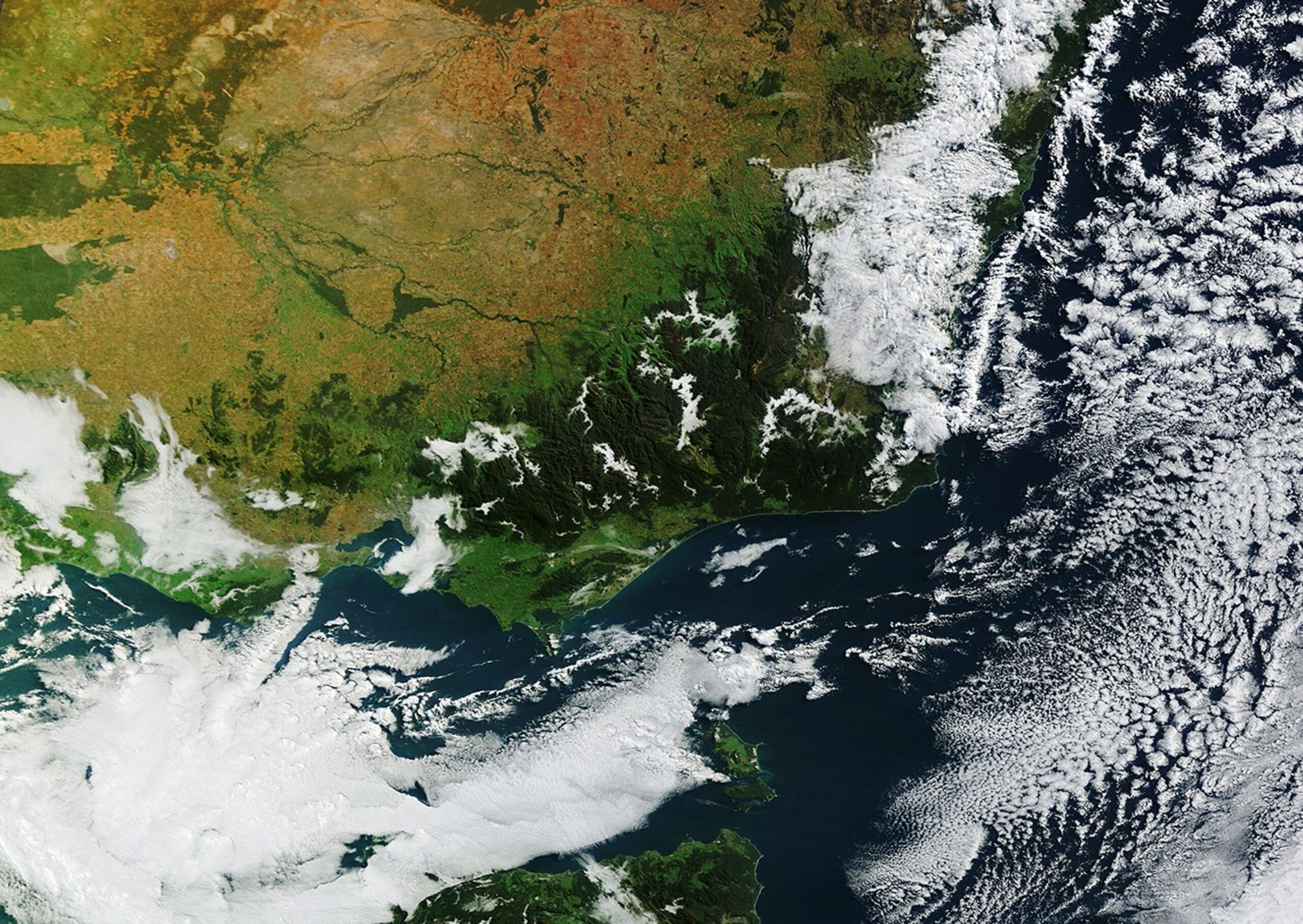
As autumn takes hold in Australia’s Southern Hemisphere, the Victorian Alps transform into a landscape shrouded in thick morning fog. Captured by NASA’s Terra satellite, these breathtaking images reveal dense radiation fog filling valleys across several national parks nestled in the mountains of eastern Victoria during May.
The Science Behind Victoria’s Seasonal Fog
With autumn’s arrival, nights grow longer and the atmosphere cools more profoundly. This extended cooling allows the air temperature to approach the dew point—the critical threshold at which air becomes saturated and water vapor condenses into tiny droplets, forming radiation fog. Unlike other types of fog, radiation fog specifically forms during clear, calm nights when the ground loses heat rapidly through radiation.
In the Victorian Alps, the geography plays a pivotal role. Cold, dense air naturally sinks and settles into valleys, creating perfect pockets for fog to develop first. While radiation fog often dissipates quickly in low-lying areas as the sun rises and warms the ground, it lingers longer in mountain valleys due to their prolonged shading. On the day these images were taken, geostationary satellite data indicated the fog persisted for nearly two hours into the morning.
Unlike clouds that hover high in the sky, fog is essentially a cloud resting at ground level, composed of minuscule water droplets suspended in the air. The valley fog captured here is a classic example of radiation fog, initiated by a combination of moist land surfaces and calm weather conditions.
Moisture Sources Amplify Fog Formation
Several days before the fog appeared, a cold, damp weather system saturated the region’s landscape, moistening soils and vegetation. This set the stage for the slow-moving high-pressure system that followed, bringing calm and warmer conditions conducive to fog development.
Adding to the fog’s intensity, numerous rivers, creeks, and lakes weave through the alpine valleys, providing a continual source of water vapor. In the images, fog forms prominently along water bodies such as the Mitta Mitta River, Buffalo River, Livingston Creek, Lake Dartmouth, and the iconic Snowy River. These aquatic corridors saturate the air locally, intensifying fog formation and creating the dramatic, low-lying clouds that wrap the landscape.
Unique Coastal Cloud Formations Over Port Phillip Bay
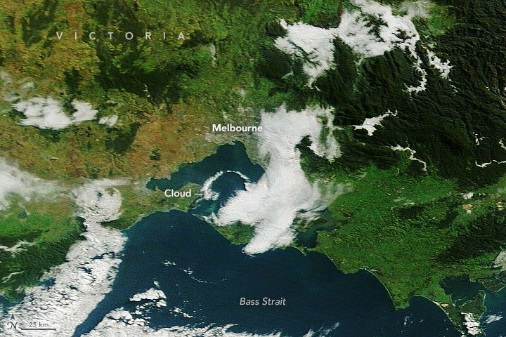
Just a few hundred kilometers southwest of the Victorian Alps, the same atmospheric conditions gave rise to an extraordinary cloud formation over Port Phillip Bay. At approximately 8:19 a.m. local time, the Terra satellite captured an arch-shaped cloud stretching from St. Leonards on the bay’s western shore to Mount Eliza on the eastern side.
This striking feature likely resulted from the interaction of converging land and sea breezes colliding with the bay’s distinctive horseshoe-shaped terrain. As the valley fog to the northeast began to dissipate, geostationary satellite imagery documented this arch-shaped cloud advancing southward across the bay, highlighting the dynamic interplay of local meteorology and geography.
Why This Matters: Understanding Fog’s Role in Alpine and Coastal Ecosystems
Fog in the Victorian Alps is more than a picturesque phenomenon; it plays a vital ecological role. By delivering moisture directly to plants and soils, fog supports alpine biodiversity, especially during drier periods. The persistence of radiation fog also influences local microclimates, affecting everything from wildlife behavior to water cycles.
Similarly, coastal cloud formations like the one over Port Phillip Bay reveal how land-sea interactions shape weather patterns crucial for marine and coastal ecosystems. These clouds impact sunlight penetration, temperature regulation, and even the distribution of nutrients in coastal waters.
For residents and visitors, awareness of fog’s behavior can improve safety, particularly in mountainous regions where fog reduces visibility and alters driving conditions. Additionally, studying these patterns enhances meteorologists’ ability to forecast weather accurately, benefiting agriculture, tourism, and natural resource management in Victoria.
Looking Ahead: Monitoring Fog in a Changing Climate
As climate patterns evolve, understanding the formation and frequency of radiation fog becomes increasingly important. Changes in temperature, humidity, and land use could alter how often and how long fog blankets the Victorian Alps and coastal areas. Continued satellite monitoring and ground observations will be crucial to tracking these shifts and assessing their ecological and societal impacts.
NASA’s Terra satellite images provide a stunning window into these transient yet critical weather events, offering scientists and the public alike a clearer view of the complex atmospheric processes shaping Australia’s unique landscapes during autumn.
In summary, Victoria’s autumnal fog season showcases the intricate dance between geography, weather, and climate—reminding us of nature’s delicate balance and the ongoing need to study and protect these vital environments.