

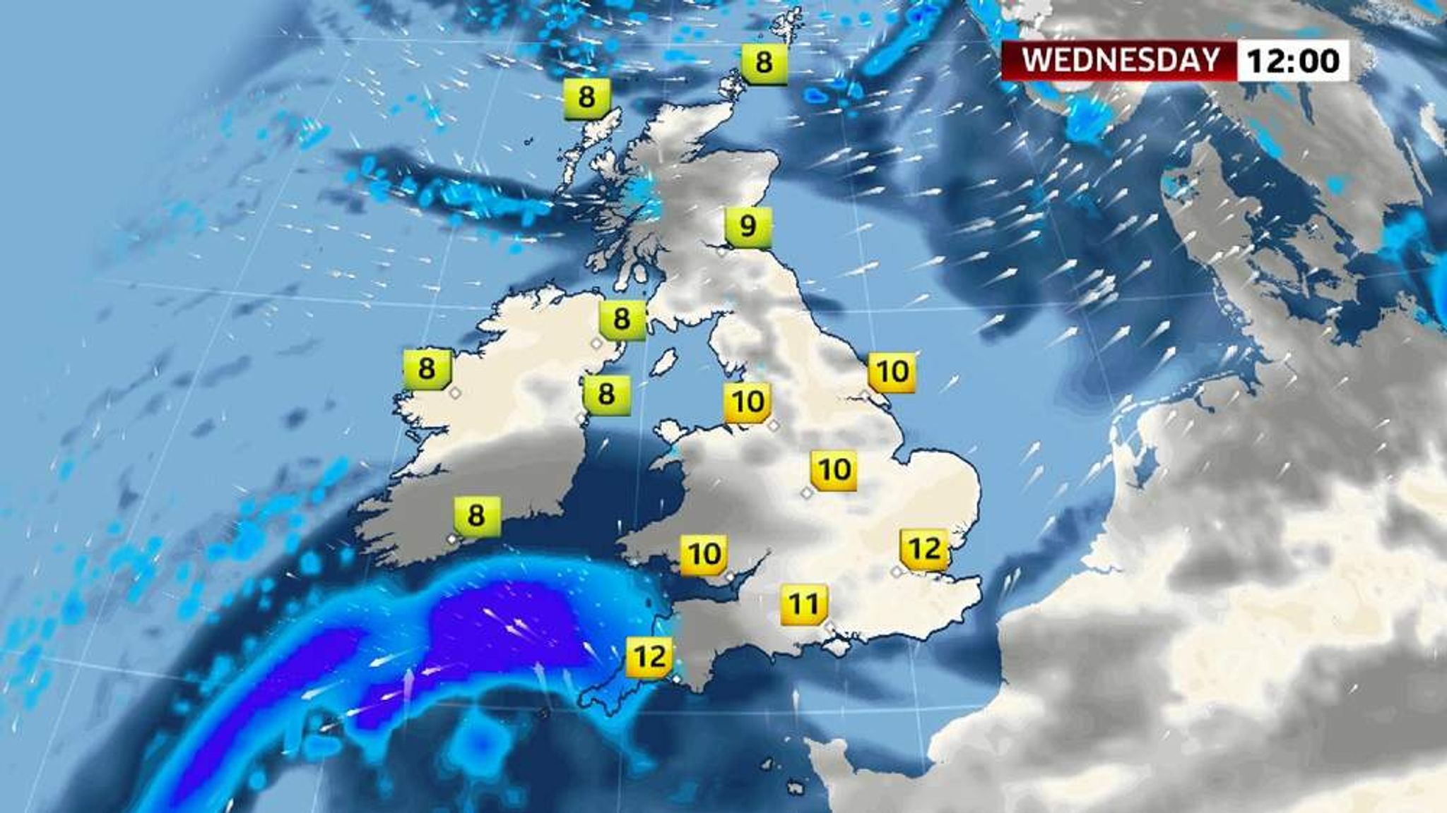
The aftermath of the intense polar vortex that gripped the United States is now barreling toward the United Kingdom, bringing with it a fresh threat of heavy rain and flooding to regions already grappling with saturated ground and swollen rivers. This developing weather pattern promises to test the resilience of flood defenses and the patience of communities still recovering from recent deluges.
The Polar Vortex’s Journey Across the Atlantic
The extraordinary cold snap that froze much of America is finally breaking up, but its legacy is far from over. A significant weather system, once part of the record-setting polar vortex responsible for subzero temperatures in many US states, is now tracking eastward across the Atlantic Ocean. As it travels, the system gradually warms, yet it still carries enough moisture and energy to produce heavy rainfall when it reaches the UK.
The Met Office has been closely monitoring this transition, already extending its severe weather warnings into Thursday morning. The forecaster emphasizes that the southern parts of England and Wales, where recent storms have left rivers overflowing and the ground saturated, face the risk of further flooding. This new influx of rain threatens to exacerbate existing challenges in managing water levels and protecting vulnerable communities.
Dominic Waghorn, Sky’s US Correspondent, explained the phenomenon with clarity: “The worst of the big freeze in America should now be over, with temperatures set to rise. That’s good news for Americans but not necessarily for the rest of us.” He highlighted that when a polar vortex dissipates, its energy disperses in all directions, sometimes unleashing extreme weather far from the original cold outbreak, in this case, toward Europe.
The Met Office predicts that Wednesday into Thursday will bring “periods of heavy rain” especially affecting the southwest of England and Wales. Rainfall totals between 30 and 40 millimeters are expected in the wettest areas, which could be enough to trigger additional flooding where the ground cannot absorb more water.

Flood Risks and Warnings Across the UK
The Environment Agency currently has no severe flood warnings in effect, a hopeful sign that the worst immediate dangers are easing. However, 114 flood warnings remain active nationwide, signaling that flooding is still a pressing concern. In addition to these, 195 low-level flood alerts have been issued, urging vigilance across various regions.
Paul Mustow, the Environment Agency’s flood risk manager, issued a stern reminder to residents: “The risk of flooding continues this week, with communities in the South West and South East urged to stay safe and sign up to free flood warnings.” His message underscores the ongoing vulnerability of these areas despite recent improvements in weather conditions.
Since the Christmas period began, floods have taken a heavy toll in England and Wales. Tragically, seven lives have been lost, and more than 1,700 homes and businesses have suffered flooding. The new year alone has seen approximately 550 properties impacted in England, with around 140 additional properties flooded in Wales. These figures illustrate the scale and persistence of the flooding crisis that communities face.
Flood defenses have played a crucial role in limiting damage. Over the Christmas period, such defenses safeguarded around 220,000 properties, and during an earlier coastal flooding event in December, another 800,000 properties were protected. Despite this, the challenges remain formidable, especially when combined with the impact of high winds experienced over the holidays.
Windstorms during the Christmas period caused power outages affecting 250,000 homes, with some families enduring multiple days without electricity. The compounding effect of wind damage and flooding has stretched emergency services and infrastructure to their limits.
Government Response and What Lies Ahead
Environment Secretary Owen Paterson has emphasized the government’s commitment to supporting affected communities. Efforts include close collaboration with local councils, the insurance sector, and other stakeholders to ensure that those impacted can access aid swiftly. Coordinated response measures are critical in mitigating the long-term consequences of flooding and storm damage.
Looking forward, meteorologists and emergency planners remain on high alert as the UK braces for the arrival of this remnant polar vortex system. The combination of already saturated soils, high river levels, and incoming heavy rainfall presents a complex challenge. Authorities continue to advocate for public vigilance, encouraging residents to stay informed through official warnings and to prepare for possible disruptions.
Why This Matters
The unfolding situation highlights a growing pattern of extreme weather events with far-reaching impacts. The polar vortex, a powerful and sometimes unpredictable force, demonstrates how climatic phenomena originating in one continent can cascade across the globe, influencing weather thousands of miles away.
For the UK, the key concerns center on flood resilience, emergency readiness, and community safety. The recent events serve as a stark reminder of the importance of robust infrastructure and effective communication in weather crisis management. As climate variability continues to increase, understanding and preparing for such interconnected weather effects becomes essential for minimizing harm and safeguarding livelihoods.
Ultimately, while the polar vortex’s freezing grip may have eased on the United States, its aftershocks present a serious test for the United Kingdom’s ability to cope with escalating weather extremes in an ever-changing climate landscape.